Friday, February 24, 2012

Feb 23, 2012 - Stevens Trail

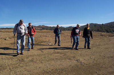
Stevens Trail was a good hike even with only five guys, L1, L2, Glenn, Larry & Tom. All other Geezers were still wheezing from last weeks killer hike with Glenn! It was good to have Tom with us again. The hike was 9 miles but we all survived without incident, except for one senior moment when Loren(1) had to go back to the truck just to be sure he had locked it. It was locked and for his moment, he got to go back up one of the steepest parts of the trail twice. He was thinking he was just getting old (that is, becoming a senior geezer from a junior geezer) and had sat around too much this winter. When he got home and was still tired, then it dawned on him, he had given a unit of blood just last Friday. He is blaming his unprecedented fatigue on loss of blood. And he is sticking to the story.
Here are my pics
Loren


Friday, February 17, 2012

Feb 16, 2012 - Western 13 mile Trail to Cool


Well Glenn did it again- he out did the infamous Lake Berryessa hike. Yesterday's 10 mile/moderate hike (American Canyon to Cool) ended up as a 13 mile/strenuous hike. There was and nearly 2000’ of vertical going up and down those false summits. Glenn and Rich had to go ahead of the group of Geezers to get the cars and pick up the group on Rte 49, a full mile from the end of the Death March! The 7 of us (Glenn, Rich, Larry, Merrill, Sherm, JD and me) barely had enough energy to get out the cars to order our ice cream. We probably looked like the typical desert survivor crawling in the sand to the mirage/oasis for drinking water when we approached Foster's Ice Cream. Thanks Glenn, we still love you, but it's the last time you get to choose the hike as some of us Geezers are not getting any younger! A few more hikes like this and you'll have to re-name us the wheezer group!


Another point of view: This week, 7 geezers (John, Merrill, JD, Sherm, Larry, Rich and Glenn) hiked in the Auburn State Recreation Area. The hike started at Gate 3 of Auburn Lake Trails subdivision, and descended down the American Canyon Trail until it intersected the Western States Trail (WST). We then followed the WST to the Quarry and Hwy 49 crossing. None of us had hiked the middle portion of the WST. Rich and Glenn went ahead to the Fire Station in Cool to complete the car shuttle, and returned to pick up the remainder at the Quarry. The hike we thought would be about 10 miles, scaling off the maps we had. However, trail signs, as well as the GPS showed we travelled closer to 12 miles just to get to the Quarry, and another mile back to Cool. (Oops!) In all, this turned out to be one of our longest hikes. Fortunately we had beautiful weather and most of the trail was relatively level, with a dense tree canopy, and several small stream crossings. There were a couple of surprise grades that turned out to be a lot steeper than any of us had remembered. But with the motivation of ice cream to follow, everyone continued on. Maybe next week we can find a trail that's even longer...
Glenn.


Monday, February 13, 2012

Feb 9, 2012 - Auburn Ravine Area

This Thursday, eleven Geezers hiked in the Auburn State Recreation Area along the Stagecoach trail and portions of the Manzanita trail, Robie Point FBT, and Riverview Trails for a distance of about eight miles. The eleven Geezers attending were Vello, Rich, Sherm, Rod, Larry, Wayne, JD, John, Loren, Merrill and Glenn. We crossed several small side creeks, and found one bridge that could hold ten geezers with one taking the photo. We had views of the American River, a waterfall, beautiful skies, and mostly dry trails. We (Glenn) rated the hike as moderate.
It was an amazing warm day for February, and a good time was had by all. Again, ice cream was the final reward for a great day of hiking.
Thanks to Glenn and Rod for this weeks photos.


Saturday, February 4, 2012

Feb 2, 2012 - South Fork of the American River


This week, the Geezers hiked the South Fork of the American River - actually Folsom Lake when it's full. This is the annual loop hike we take that utilizes the Old Salmon Falls bridge that is usually underwater ten months of the year. It was the third or fourth time we've hiked this loop, except this year was different as we hiked it counterclockwise! We started at the trail head on Salmon Falls Road, hiked on the south side of the river to the Salmon Falls bridge, crossed over to the north side of the river, and back to the Old Salmon Falls bridge and the trail head. This hike was around 8 miles and rated as moderately easy.